File:US map - states.png
Size of this preview: 800 × 542 pixels. Other resolutions: 320 × 217 pixels | 640 × 433 pixels | 1,024 × 694 pixels | 1,478 × 1,001 pixels.
Original file (1,478 × 1,001 pixels, file size: 356 KB, MIME type: image/png)
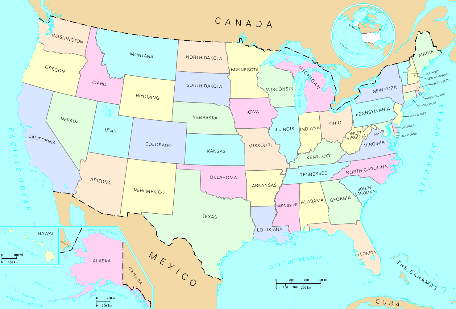
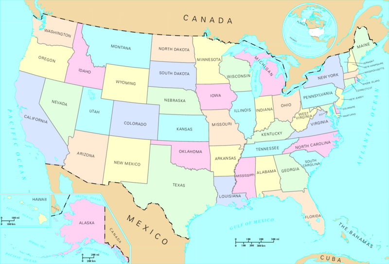
| Description | States of the United States. | |||
| Source | http://nationalatlas.gov, there also available as PDF | |||
| Author | US Department of Interior | |||
| Permission (Reusing this file) |
|
|||
| Other versions |
|


List of images provided by user Duesentrieb (This link helps me to find all my images) -- Duesentrieb
File history
Click on a date/time to view the file as it appeared at that time.
| Date/Time | Thumbnail | Dimensions | User | Comment | |
|---|---|---|---|---|---|
| current | 15:46, 12 May 2008 | | 1,478 × 1,001 (356 KB) | Jon Harald Søby | cropped to remove watermarks |
| 15:08, 12 November 2004 |  | 1,584 × 1,224 (243 KB) | Duesentrieb | States of the US; Dept. of Interior, Public Domain |
File usage
The following page uses this file:
Global file usage
The following other wikis use this file:
- Usage on bs.wikipedia.org
- Usage on cy.wikipedia.org
- Usage on fr.wikipedia.org
- Usage on hr.wikipedia.org
- Usage on nds-nl.wikipedia.org
- Usage on ro.wikipedia.org
- Usage on simple.wikipedia.org
- Usage on sl.wikipedia.org
- Usage on vls.wikipedia.org